A new study of Greenland’s ice sheet using long-term satellite records by Liverpool glaciologist, Dr James Lea, forms part of a collection of new insights into the planet’s changing frozen regions.
Dr Lea presented his research today (Monday, 9 December 2019) at a press conference organized by NASA at the American Geophysical Union’s conference in San Francisco.
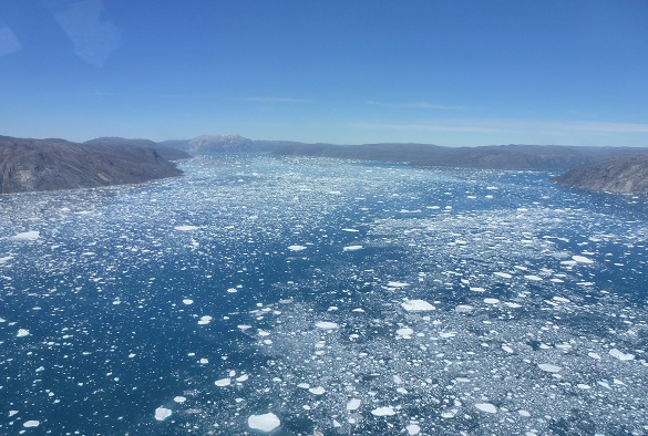
Using different satellite records, his study reveals that meltwater ponds are creeping up to higher elevations in the last decade, which could impact how fast ice flows.
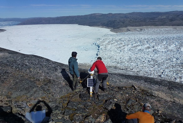
Dr Lea used the computing power of Google Earth Engine to analyze images of the Greenland ice sheet from the Moderate Resolution Imaging Spectroradiometer (MODIS) on the Terra satellite for every day of every melt seasons over last 20 years – which amounted to more than 18,000 images in total.
He said: “We looked at how many lakes there are per year across the ice sheet and found an increasing trend over the last 20 years: a 27 percent increase in lakes. We’re also getting more and more lakes at higher elevations – areas that we weren’t expecting to see lakes in until 2050 or 2060.”
“When these high-elevation meltwater ponds punch through the ice sheet and drain, it could cause the ice sheet to speed up thinning the ice and accelerating its demise.”
Dr Lea’s new satellite data of Greenland was presented alongside three other studies which use satellite data to reveal how the changes taking place to frozen areas of the planet.
Glaciologist Mark Fahnestock of the University of Alaska used images from the Landsat mission dating back to 1972 and continuing through 2019, to stitch together six-second time-lapses of every glacier in Alaska and the Yukon. Landsat is a joint effort of NASA and the U.S. Geological Survey (USGS).
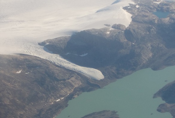
Michalea King of The Ohio State University analysed data from Landsat missions dating back to 1985 to study more than 200 of Greenland’s large outlet glaciers. She found that Greenland’s glaciers retreated an average of about 3 miles (5 km) between 1985 and 2018.
Devon Dunmire of the University of Colorado used microwave radar images from the European Space Agency’s Sentinel-1 satellite to see where subsurface lakes are.
Dr Lea was part of a panel of scientists who presented their findings at a press conference at AGU’s annual fall meeting in San Francisco. You can watch the press conference here https://live.projectionnet.com/AGUPress/FM2019.aspx
Dr Lea will present the paper` Supraglacial lake mapping of the entire Greenland Ice Sheet using Google Earth Engine’ at the AGU Fall Meeting on Wednesday, 11 December 2019.
Earlier this year, Dr Lea was awarded a prestigious UKRI Future Leaders Fellowship to undertake research to better understand how glaciers will change across both polar regions.