Experts from the University’s Department of Geography and Planning will head up a new research project to improve the safety of ports using satellite and radar data to identify changes in water depth.
Led by Dr Jonny Higham, a lecturer in contemporary processes and dynamics, the project also involves two UK maritime SMEs; Marlan Maritime Technologies Ltd and Satellite Oceanographic Consultants Ltd (SatOC).
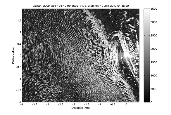
The project will use a combination of satellite and land-based radar data and novel data analysis methods (machine learning and modal decomposition) to monitor changes in sub- and intertidal bathymetry to alert port operators to changes in water depth that threaten safe navigation.
It is one of eleven projects funded by the funded by the Maritime Research and Innovation UK (MarRI-UK) , a Government and industry backed initiative to boost collaborative innovation and jointly tackle key technology challenges in UK Maritime.
Dr Jonny Higham said: “Using observed patterns in wave reorientation and breaking, we can identify changes in water depth according to patterns of erosion and deposition on the seafloor.
“The detected changes range from long-term trends in sedimentation and sea level to event-based changes due to storms. Monitoring these changes is critical for ports to assure sufficient water depth in maintained navigation channels and docks, as well as for targeting dredging operations.”
Marlan Maritime Technologies is a Liverpool based maritime company and has collaborated with the University’s environmental scientists on a number of projects since 2012 including PhD projects and a Knowledge Transfer Partnership.
Alex Sinclair, Managing Director of Marlan Maritime Technologies said: “We’re delighted to be working with experts at The University of Liverpool and SatOC to push the boundaries of coastal science. This project will develop new methods of nearshore water depth calculation using a unique combination of observations from space, our Synoptic4D radar systems, coastal ocean models and innovative machine learning techniques.
“We’re excited to get started! The planned outputs of this project are founded in the needs of the coastal management industry: local council authorities are having to deal with increased coastal erosion on multiple fronts whilst port authorities face continued siltation of navigation channels and docks. This project will give end-users much greater situational awareness at reduced costs. It will result in increased coverage, availability and value of the service that can be offered to ports around the UK and worldwide.”
SatOC is a UK-based SME specialising in the applications and exploitation of satellite oceanography.
SatOC Managing Director, David Cotton, said: “This award provides a welcome opportunity for SatOC to work with Marlan and the University of Liverpool to apply its experience in working with satellite data in an innovative project located close to home. SatOC will supply satellite and model data which will provide essential wider regional data on wave conditions as input to the detection of changes in nearshore bathymetry.”
Professor Andy Plater, Head of the University’s Department of Geography and Planning, added: “We are so proud to be part of this flagship initiative to apply our expertise in coastal processes, modelling and data science in such an innovative way to address problems facing a wide spectrum of maritime end-users. This project not only addresses issues of safe port navigation but also aims to reduce carbon emissions though efficient maritime transport and optimized dredging operations. It further demonstrates the leading position of Liverpool’s maritime sector in technology development and innovation.”
The MarRI-UK initiative is supported by the UK Department for Transport (DfT) and aids the development of technological innovation to improve the services and operations of UK maritime.
John Howie MBE, Chair of MarRI-UK, said: “The 11 successful projects are great examples of UK technology and innovation, helping the UK maritime sector meet the challenges and goals set out in the Maritime 2050 vision.”